Monday, 5 August 2013

JOGLE Awards

A few people have asked me to list my favourite experiences of the journey, so in response to this request, I have set out my personal favourites in a handful of categories.

It's been impossible to whittle down the contenders to a top three, so I've bottled out and listed all of the contenders in chronological order.

Best Accommodation (excluding family and friends!):

1. Impala B&B, Wick
2. Culgower House B&B, Loth
3. Rowardennan Youth Hostel
4. Green Shadows B&B, Drymen
5. Buchanan Galleries Premier Inn, Glasgow
6. Marchbankwood B&B, Beattock
7. Stowe View B&B, Knighton
8. Black Dog Inn, Black Dog
9. Number 59 B&B, Okehampton
10. East Raddon Farm B&B, Lewdown
11. Townhouse Rooms B&B, Truro
12. Ship Inn, Mousehole

Best Meals (excluding family and friends!):

1. Culgower House B&B, Loth
2. Fiddler's Rest restaurant, Drumnadrochit
3. Eagle Barge Inn, South Laggan
4. Cobb's Bistro, Fort William
5. Crianlarich Hotel, Crianlarich
6. Rowardennan Youth Hostel
7. Clachan Inn, Drymen
8. Panoramique restaurant, Liverpool
9. Prego restaurant, Monmouth
10. Mamma Mia restaurant, Chepstow
11. Black Dog Inn, Black Dog
12. East Raddon Farm, Lewdown
13. Blue Haze restaurant, Porthleven
14. Ship Inn, Mousehole

Best Walks:

1. John O' Groats to Wick
2. Brora to Golspie
3. Inverness to Drumnadrochit (Great Glen)
4. Kinlochleven to Inveroran (West Highland)
5. Crianlarich to Rowardennan (West Highland)
6. Carnforth to Garstang (Lancaster Canal)
7. Chirk to Llanymynech (Offa's Dyke)
8. Hay on Wye to Llanthony (Offa's Dyke)
9. Okehampton to Lewdown (Two Castles)
10. Porthleven to Mousehole (South West Coast)

Best Views:

1. Orkney isles from John O'Groats
2. Brora beach
3. Kinlochleven from West Highland Way
4. Buachaille Etive Mor and Glen Coe from West Highland Way
5. Loch Lomond from Conic Hill
6. Glasgow from my 18th floor hotel room
7. Lakeland fells from Penrith
8. Wirral peninsula and North Wales from Panoramique restaurant, Liverpool
9. 360 degree view from Moelydd, Offa's Dyke
10. Llanthony Priory from Offa's Dyke
11. St Michael's Mount from South West coast path

Heroes and heroines:
1. Calum from Craigdon Mountain Sports in Inverness for fixing my boot
2. Lynda for being my first walking partner and for lightening my heavy load
3. Donna from Cotswold Outdoor, Liverpool for making my replacement boots so comfortable
4. The staff at the Wetherspoons Central hotel, Shotton for kindness and generosity to a hot and thirsty walker
5. Derek from Newcastle on Clun for being a Good Samaritan to two hot and very thirsty walkers when the local pub didn't open
6. Russell George (Welsh MP, not me!) for giving his time to meet up
7. Sylvia from East Raddon Farm, for accommodating me with open arms, despite a double booking
8. Family and friends who provided accommodation, meals, transport, washing facilities, kit handovers and other services
9. All who joined me on the walk, most of whom left in a worse physical condition than they arrived (sorry!)
10. All the B&Bs, pubs and shops that provided free lunches and drinks
11. My family

Comments welcomed on any of my choices!

Sunday, 4 August 2013

Mission accomplished! My initial observations......

Now that the dust has settled and I've unpacked my rucksack, put away my walking boots and cleared my mountain of mail, I've had a chance to reflect on my two month journey and offer some initial observations.

I set off in early June with three main objectives: to survive, to raise as much money as possible for Cancer Research UK, and to enjoy myself.

I survived! After I'd resolved the issues with my right boot in the first week, I was untroubled for the rest of the walk. I was surprised at how well my mind and body coped with the daily onslaught. I didn't wake a single day with any doubts about walking and I feel fitter than I've felt in many years. My feet are in good condition and bear no scars from almost a thousand miles of action.

I'm really grateful to everyone who donated to the cause, from people I know well, to complete strangers. I've raised over £13,500 to date and am confident that I can achieve my increased target of £15,000. Donations still welcome!

My immediate reaction is to state that I did enjoy most of the journey. Yes, there were moments (ok, minutes!) when blisters or excessive heat caused discomfort, but these periods were completely overridden by the wonderful scenery and the companionship of fellow walkers. In truth, my level of enjoyment increased as the walk progressed, perhaps as the prospects of completion increased.

I put much time into route planning and accommodation booking earlier in the year, so am delighted that my efforts paid off. With the exception of a few footpaths which did not materialise, the routes were a great success, often managing to balance conflicting objectives of the shortest route and the most scenic. My accommodation exceeded all expectations, not only in terms of providing a bed, a hot bath or shower and breakfast, but particularly with regard to the friendly and welcoming hospitality offered by my hosts.

My equipment served me well. My walking boots had to be stretched, then eventually replaced due to wear and tear, but my second pair had no opportunity to be broken in, yet remained completely comfortable to the end. My rucksack accommodated everything with ease and, though quite heavy, fitted well. My waterproofs had very limited use, but performed well when called upon. Star item was my smartphone, which acted as phone, text, internet, GPS mapping, camera, weather alert, and blog provider - all from a device which fits in my pocket.

My approach to the entire journey was to take each day at a time. While this sounds like a sporting cliche, it allowed me to focus on the current walk and not be overwhelmed by the daunting prospect of the bigger picture. I found that this approach worked well for me and took pleasure out of ticking off each day's completed mileage.

I'd expected the first week or so of the journey from John O' Groats to be lonely, but I underestimated the scale and duration of this. I hadn't expected to see or communicate with so few people during the walk, but even on the Great Glen Way and the West Highland Way, most walkers were travelling in the opposite direction, which limited the opportunity for enhanced conversation.

My lasting impression of the walk is that Great Britain is still very much a green and pleasant land. Scotland is much greater in length than most people appreciate, but my route slice through England and Wales included so few urban or industrial areas (Preston, Liverpool and Avonmouth), that it is difficult not to view most of the walk as rural. As a consequence, I encountered varied landscapes of hills and valleys, rivers and canals, farmland and forests, a slower pace of life, a closer relationship with nature and a heightened sense of community, history and tradition. Long may it remain.

I really enjoyed meeting up with family and friends during the journey, although practically this was mainly restricted to England and Wales. It was fantastic to meet up with people I hadn't seen for some time (some for over twenty years), even if it was only a fleeting visit. Similarly, it was good to walk with companions, even if some left in greater pain than they arrived!

Another overarching memory is of the kindness of strangers, not just in donating to my cause, but in frequently going way beyond the normal boundaries. This extended to accommodation providers, walkers, pub landlords, shop owners and complete strangers - the man who invited us to join his family for a drink when the local inn was closed was not an isolated example.

I can't review my journey without mentioning the weather. I read a few blogs from people who'd undertaken the same journey in the summer of 2012 and they regularly mentioned rain, waterproofs, mud and puddles. I duly planned for similar conditions, so was pleasantly surprised that northern Scotland provided sunshine. What I didn't expect was the extended heatwave, from Lancashire to Somerset. This provided an additional challenge to the hilly Offa's Dyke section of the walk, especially in ensuring that sufficient liquids could be obtained en route. The rain I experienced was pitifully little, so my waterproofs barely made a handful of appearances in 57 days.

My gripes are few and insignificant. Some footpaths were poorly signposted or overgrown (some were both!), some A roads did not cater for pedestrians and cyclists to the point of being dangerous (mostly in Cornwall) and too many pubs were closed when there is clearly demand for them at lunchtimes.

A number of people have already asked if I would repeat the journey. My straight answer is that I would, with minimal changes, but I simply couldn't replicate the unique atmosphere and circumstances of undertaking the walk for the first time, such as the prospect of a journey into the unknown or the fundraising challenge. However, I'm sure there's another adventure in the making.........

My next blog will report my favourite accommodation, meals, walks and views, as well as paying tribute to some heroes and heroines.

Friday, 2 August 2013

Day 57: Mousehole to Land's End

Distance: 11.0 miles
Time: 4 hrs
Weather: Sunny
Cumulative distance: 955.8 miles

The final day. A gentle stroll with the children, one last missing footpath, arrival at Land's End and, eventually, home.

We had a late family breakfast (nine o'clock being the earliest possible), then Daniel, Hannah and I set off in glorious sunshine. Time prevented us from following the coast path, so we walked along minor country lanes to Lamorna, then joined a track which climbed out of the valley.

Fate had decreed that there should be one final detour due to a disappearing footpath. The initial signpost was present and the map clearly set out the route between two farms. Reality led us to a field of wheat and another field blocked by wire netting. I adopted my usual approach - don't panic, head in the right general direction and cross fingers and toes. Fortunately it worked again as we rejoined a minor road, resulting in only a small detour.

We were all a little thirsty, so when a country pub appeared out of the blue, we readily agreed to stop for final refreshments. We walked the final few miles along a B road, then Carole joined us for the last quarter of a mile to Land's End. Due to the detour and additional stops, I was one hour later than planned, but it didn't matter.

Crossing the official finish line was, to my surprise, not an emotional experience. No sense of relief, more sadness that the journey was over. The sun was shining, which felt like a really fitting end after two months of remarkably good weather. We walked to the reception at the Land's End Hotel, where I had my official record card stamped, then strolled over to the official signpost for the obligatory photo. As the photographer snapped away, a crowd of onlookers burst into applause.

We had lunch at the hotel restaurant - I celebrated with a Greek salad and a pint of Tribute ale. Then it was time to depart for home. Job done.

We called in very briefly at East Raddon Farm, to visit Sylvia and her family. Unsurprisingly, her hospitality stretched to tea and cakes. We finally arrived home at 11pm.

I've decided to keep my blog running for a few more days. I'll set out my observations on the overall journey, but I've also been requested to list my favourite walks, views, accommodation and meals etc, so I'll include those too.

Day 57: NEWS FLASH - LAND'S END

Just arrived at Land's End!!! Full blog to follow later.

Thursday, 1 August 2013

Day 56: Porthleven to Mousehole

Distance: 16.5 miles
Time: 6 hrs 55 mins
Weather: Cloudy
Cumulative distance: 944.8 miles

A day on the South West coastal path - an exhilarating clifftop hike, followed by a sea front walk through Penzance and Newlyn.

After a family breakfast, and once Daniel was finally ready to depart, we set off along the path to the opposite side of the harbour. Hannah joined us for the first few minutes, then returned to the prospect of her other love, shopping.

We joined the South West coastal path and, within minutes, we were walking along the undulating, honeysuckle clad clifftop track, with magnificent views along the rocky coastline and down to the crashing waves below. We encountered a number of old industrial ruins along the path, as well as wild ponies and a peregrine falcon.

We stopped for lunch (inevitably, Cornish pasty) and a pint of Trelawny ale (well, a coke for Daniel) at Marazion, where the clifftop path gave way to a flat track along the sea front to Penzance. The route then alternated between roads and footpaths through the fishing town of Newlyn, before we turned around the coast and arrived at Mousehole (pronounced 'Mauzl'), where we had a family room booked at the Ship Inn.

We had a delicious meal at the Ship (I opted for wonderfully fresh mackerel) and I sampled the HSD ale from St Austell brewery. Afterwards, right outside our bedroom window, we were treated to a display from a troupe of Morris dancers.

So, the end is nigh. After months of planning and training, followed by eight weeks of strenuous walking, the final day is about to dawn. It's difficult to believe that this mammoth journey is nearly over, but I really have run out of country, so Land's End is an appropriate conclusion.

Wednesday, 31 July 2013

Day 55: Truro to Porthleven

Distance: 21.2 miles
Time: 7 hrs 55 mins
Weather: Light drizzle
Cumulative distance: 928.3 miles

A day of country lanes and footpaths in the drizzle, a few missing signposts, the seaside and a family reunion.

After breakfast, we set off in drizzle and soon reached a country lane which took us away from civilised Truro towards Bissoe, but which was also a short cut popular with local motorists.

We stopped for an early lunch at Stithians - our first Cornish pasty, which we ate whilst sat on a bench in the rain. It still tasted good, even if we departed somewhat damper.

We followed a couple of footpaths which resulted in shorter routes, but came unstuck on a later footpath due a lack of signposts. We found ourselves next to a reservoir, having deviated from the scheduled route, but quickly found an alternative route. Unfortunately, another missing signpost resulted in a further deviation and we were soon walking across a field in the mist, not quite sure how to rejoin our route. With the assistance of GPS, we were back on track, but time and miles had been expended unnecessarily.

At Porkellis, we stopped for a coke at an inn. As we left, the landlord came running after us to tell us we were heading in the wrong direction for Land's End, so I had to explain that we would be walking along the scenic coastal path to get there.

After a longer than planned walk, which Daniel's legs did not appreciate, we skirted Helston, climbed over the hill and finally arrived at the bustling harbour of Porthleven, to be reunited with my wife and daughter for the first time in two months.

Our hotel was nearby, offering super views across the harbour (see photo). This was the first time I'd been so close to the sea since the early days of the walk in Scotland. It was good to smell the brine and to hear the sound of the gulls flying overhead.

We had a family meal at the Blue Haze fish restaurant on the opposite side of the harbour. The meal was excellent and there were splendid views over the harbour. My drink? A bottle of Porthleven ale from Skinner's brewery - what else?

Tuesday, 30 July 2013

Day 54: Roche to Truro

Distance: 18.7 miles
Time: 6 hrs 30 mins
Weather: Morning drizzle, dry and bright later
Cumulative distance: 906.1 miles

Cornish country lanes in the rain, danger on the A39, quiet tracks, 900 miles clocked and delightful accommodation in Truro.

We each consumed the contents of our Travelodge breakfast box (orange juice, cornflakes and milk, croissant and muffin), then set off in light drizzle to the centre of Roche, where we purchased lunch from the Co-op.

We passed through Nanpean and St Stephen, before stopping at Ladock, where we sat on a bench next to the portacabin shop and post office to have lunch. Soon afterwards the rain stopped and the sun gradually saw off the clouds.

After St Erme we had to join the main A39 for about a mile. Despite being a busy, major road, there were no cycle or pedestrian paths and the grass verges were either too narrow or non existent. This only confirmed my observation that Cornwall's major roads are the least pedestrian and cycle friendly of all the roads I have experienced in the last two months.

It was a relief to join a minor country lane which followed a wooded valley and eventually led us to the outskirts of the fine city of Truro. Inevitably, our B&B was located at the top of a hill just outside the town centre.

The Townhouse provided a friendly welcome,a very comfortable room and a hot shower, but additionally it offered complimentary hot drinks and home made cakes.

In bright sunshine, we wandered down the hill to explore the centre of Truro. The shops were closed, but we did spot the Christmas shop (only 147 days to go!) and the impressive cathedral, which dominates the skyline. We dined at Pizza Express, housed in the former Coinage House.

I reached the 900 mile landmark today, but the days and the miles are running out. I feel that I need to savour every remaining moment, as my epic journey nears its conclusion.

Monday, 29 July 2013

Day 53: Mount to Roche

Distance: 13.6 miles
Time: 4 hrs 5 mins
Weather: Cloudy, showers, sunny later
Cumulative distance: 887.4 miles

A leisurely morning stroll, a station reunion and a walk to an industrial estate with rural views.

I ate breakfast with Wayne and family, then they set off for home. The B&B owner kindly allowed me to stay beyond the normal departure time as, for once, I was in no hurry to leave. It wasn't the heavy showers which deterred me, but the fact that I only had 6 miles to walk before meeting my son Daniel at Bodmin Parkway station.

I followed a quiet country lane down towards the A38, when I was suddenly caught by a heavy shower for the second day in a row. I had to walk along the A38 for about 1.5 miles to the station junction, but it soon became the most difficult road of the entire journey. There was no pedestrian path and heavy goods vehicles thundered by at speed, so my only option was to jog along the roadside when there were breaks in the traffic. Crossing over to the station road proved to be another challenge as the junction was positioned next to two bends in the road. Eventually, I arrived safely at the station, which was a floral delight, with colourful displays along each platform. I ate lunch and watched the steam hauled passenger train of the Bodmin and Wenford railway arrive at the opposite platform.

Daniel's train pulled in impressively on time and I greeted him for the first time in nearly 8 weeks. He'd come to join me for the final 5 days of the walk, but I silently hoped that he'd done sufficient training while I'd been away.

We walked at pace, taking a short cut through the Lanhydrock estate, then followed a country lane which ran parallel to the busy A30 highway, until we finally reached an industrial estate, where our Travelodge accommodation was located. Despite its industrial base, our room offered rural views, including the local donkey sanctuary. We dined next door at the Victoria Inn (a wide choice of food and efficient service).

Sunday, 28 July 2013

Day 52: Launceston to Mount

Distance: 19.3 miles
Time: 8 hrs 15 mins
Weather: Rain showers
Cumulative distance: 873.8 miles

Wet weather, waterproofs, Wayne, and warm welcomes.

After another fine breakfast, I checked out and climbed the hill up to the town centre. There I met Wayne, a former work colleague, an Aussie who was born in Launceston, Tasmania. He is a cricket fanatic, having formerly partnered Test player David Boon, and still plays occasional first team cricket for Egham. Wayne had chosen potentially the wettest day to walk with me, while the rest of his family visited the Eden Project.

For the first time since Beattock in Scotland (day 21) I wore my waterproofs - that's a whole month ago! We immediately sheltered from the first shower under a shop canopy, then headed towards the quiet country lanes around Bodmin Moor. Our second shelter was a conveniently located church in a secluded village - this was despite the fact that the Sunday service that was in progress!

At Rilla Mill, we stopped for a coke at the village pub, but the enticing smell of the Sunday roasts nearly stalled us for longer. We journeyed on until Minions, where another pub lured us towards another coke, but this was more lucrative. The pub was brimming with diners and drinkers, locals and tourists alike, but they were most welcoming and gave generously at the sight of my collecting tin.

One particularly heavy downpour provided a soaking, but we dried off quickly in the subsequent breeze. We finally reached St Neot, national village of the year in 2004, where Wayne's feet decided it was time to call his chauffeur. I continued a few miles to Mount, where tonight's B&B was located. After a rapid shower, I joined up with Wayne and his family (wife Nicky and daughters Lauren and Cassie) and we drove to the London Inn at St Neot. I opted for the sea bream, served with cherry tomatoes and olives and sampled the local multi award winning brew, Betty Stogs from Skinners of Truro.

Saturday, 27 July 2013

Day 51: Lewdown to Launceston

Distance: 10.8 miles
Time: 3 hrs 30 mins
Weather: Cloudy with sunny intervals
Cumulative distance: 854.5 miles

Last night, Sylvia cooked a delicious dinner of pork in cider sauce, with a selection of vegetables (including Swiss chard, courgettes and peppers fresh from the garden). Afterwards, the two children Charlie (11) and Chloe (10), who are both very artistic, entertained me with tales of life on a farm - Chloe had already taken me up into the field to be introduced to her pet lambs, every one of which had a name! The other guests, who were also family friends, then arrived, Sylvia's husband Robert joined us and we all chatted until nearly midnight.

I had a fine farmhouse breakfast, then Ian phoned me at the farm to let me know that he wouldn't be able to join me today. Unfortunately, he had the trail guide, so I would have to navigate with the map alone. I checked out and set off across farmland and woods. The route was well marked on the map, so I need not have worried.

After a few hours, I left Devon and entered Cornwall, the final county of my journey. Land's End beckons, but the weather forecast is not encouraging.

I arrived in Launceston early, so sat on a bench in the main square and ate my lunch. I wandered around the centre and viewed the castle, but lasting impressions were of a very hilly town. Unfortunately, my B&B was near the bottom of a hill, which will mean a long and steep climb in the morning.

After a shower and a snooze, I walked a short distance down the road and dined at the White Horse Inn.

Friday, 26 July 2013

Day 50: Okehampton to Lewdown

Distance: 14.6 miles
Time: 5 hrs 50 mins
Weather: Warm and sunny
Cumulative distance: 843.7 miles

A pleasant accompanied walk along the Two Castles Trail and an accommodation hiccup.

After a delicious breakfast with extensive choices and equally extensive conversation with my host Ali, I walked down to the Tourist Information Centre to meet my two walking partners for the day. Ian, my brother in law arrived first, shortly followed by Lucie, my key contact at Cancer Research UK.

Ian lives in Plymouth and had travelled by car and bus to join me for the day and would do the same tomorrow. Lucie lives in London, but was visiting her parents in North Somerset for the weekend. She was accompanied by Diddie, her very well behaved terrier (named after Didier Drogba!).

In perfect walking conditions, we followed the trail across rolling countryside and woodland until we reached Bridestowe, where we visited the local pub for refreshments. Later on the signposts went into hiding and we strayed slightly from the route, rejoining it after crossing several fields. As with many of the official trails, we didn't pass a soul for the entire day.

We reached Lewtrenchard, where Ian had parked his car, and where Lucie and Diddie left us to retrace their steps back to Okehampton. Ian and I drove a few miles to have a welcome beer (Timothy Taylor's Landlord), then he dropped me off at my farmhouse B&B.

I could tell immediately from the look on Sylvia the owner's face that there was a problem. She'd not entered my confirmation into the book and was double booked - she was embarrassed and hugely apologetic. However, in true British spirit, within five minutes she'd produced a Devon cream tea for me and was relocating her daughter so that I had a room for the night!

Thursday, 25 July 2013

Day 49: Black Dog to Okehampton

Distance: 18.7 miles
Time: 5 hrs 55 mins
Weather: Cloudy and warm, sunny intervals
Cumulative distance: 829.1 miles

A pleasant rural walk through Devon villages, successfully managing to avoid the rain.

After a hearty breakfast, I said farewell to my welcoming hosts (who kindly made a donation) and set off down the road. I soon joined the Two Moors Way, another long distance path, which links Dartmoor and Exmoor. The path took me across farmland and through wooded glades. At one point a herd of around thirty cows followed me across a field, so it was quite a relief to reach the kissing gate into the next field. The path passed through the sleepy village of Morchard Bishop, where a senior resident told me that rain was imminent.

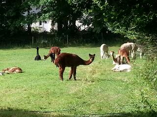
Just outside Morchard Bishop, the path weaved its way through an alpaca farm. I'd never seen these animals at close quarters before, but they seemed oblivious to my presence.

I left the Two Moors and joined a series of minor roads which passed through some pretty Devon villages - Down St Mary, Zeal Monachorum and North Tawton - with thatched cottages and impressive floral displays.

The weather forecast had indicated scattered heavy rain showers and my Rain Alarm smartphone app (which brother in law Chris had alerted me to) showed that I was surrounded by rain clouds, but amazingly I managed to avoid them and postponed donning my waterproofs for at least another day.

I arrived early in Okehampton, so ate my packed lunch in the sun and visited the Tourist Information Centre. As I arrived at my B&B, dark clouds gathered and a few raindrops began to fall. Ali, the friendly owner, told me that a few other LEJOG  walkers had stayed here  in the last year and she had printed off their blogs. I read one with amazement - one guy had walked the route in 2012 in 40 days without any rest days and most of his journey was undertaken in the rain. Impressive.

I walked down the hill and opted to eat at Vines Pizzeria, which Ali had suggested. A pepperoni pizza and two Peronis later, I ventured back up the hill.

Wednesday, 24 July 2013

Day 50 - SPECIAL APPEAL

To coincide with the arrival on my walk of Lucie, the area volunteer manager for Cancer Research UK, I would like to make a special appeal for further donations.

I have walked for seven weeks now and have one more week to go until I hopefully reach Land's End. The walk has been a tough endurance test, firstly in the early days when my boot was giving me trouble and, more significantly, in the extreme heat which has partnered me since leaving the Lake District. Those of you who joined me for sections of the walk will appreciate just how tough it was in high temperatures. But, in truth, I knew that I would face challenges when I committed to taking part - I just didn't know what form they would take!

The main purpose of the walk was, and remains, to raise as much money as possible for Cancer Research UK. Their work, which relies entirely on public donations, is critical in helping to improve the survival rates for different types of cancer and significant progress has been achieved in recent years.

Thanks to your generous contributions, I have raised nearly £12,000 so far and still have a number of committed donations in the pipeline, but I've set a target of £15,000 and it would be fantastic to be able to reach this. So, in the final few days of my epic journey, I'd like to to call on you to help me to get closer to my target.

If you haven't donated yet and would like to, if you've already donated but would like to give more, or if you have family and friends who could donate, please visit my website:

www.JustGiving.com/RussellGeorgeJOGLE

Thank you so much for the remarkable support you have given to me throughout my journey - it's been really appreciated.

Best wishes,

Russell

Day 48: Sampford Peverell to Black Dog

Distance: 16.8 miles
Time: 5 hrs 25 mins
Weather: Cloudy with sunny intervals
Cumulative distance: 810.4 miles

An enjoyable walk across rural Devon in weather conditions more suited to walking.

I walked downstairs to have breakfast, but found no signs of life - the chef had overslept! He arrived apologetically fifteen minutes later, but redeemed himself with a fine breakfast.

I rejoined the canal and finally spotted the first barge. As on a previous towpath (the Montgomery canal), I had to tread cautiously to avoid squashing hundreds of tiny frogs. The towpath ended at the Tiverton canal basin, where I treated myself to my first ice cream of the journey, a delicious blackcurrant and clotted cream cone.

The route passed through Tiverton's main shopping street, before climbing steeply to the west. Before long I was in rural Devon, almost as remote as the mountains of the West Highland Way or the hills of Offa's Dyke. I didn't meet a soul, but was treated to fine views of rolling hills and farmland.

For the first time since Day 28, weather conditions favoured the long distance walker. For much of the day the temperature was around 21 degrees and a refreshing breeze provided comfort. This brought to an end almost three weeks of walking in high temperatures, which has been an endurance test I hadn't planned.

I reached tonight's accommodation, the Black Dog Inn in the village of the same name, just before it closed after lunch. This gave me time to down a pint of iced coke before being shown to my room. A multi directional shower offered a novelty way to refresh, another first for the journey. Afterwards, for the second time today but in different inns, I managed to rescue two butterflies which had flown in through the open window.

Dinner at the inn was amongst the best of my entire journey. I had peppered steak with a variety of vegetables and home cooked chips, followed by plum tart and clotted cream, washed down with Exmoor ale.


Tuesday, 23 July 2013

Day 47: Taunton to Sampford Peverell

Distance: 18.7 miles
Time: 6 hrs 35 mins
Weather: Cloudy at first, hot and sunny later
Cumulative distance: 793.6 miles

Intensive map reading, a delightful picnic and yet another canal towpath.

I was awoken at 2.30am by the predicted thunder and lightning, but it was calm and dry by the time I was enjoying my full English breakfast. Mary, who runs the very comfortable Pyrland Farm B&B kindly donated some lunch items when I checked out.

I followed a fast route through residential areas around Taunton, then joined the West Deane Way, a 45 mile circular route which featured prominently on my Ordnance Survey map. Unfortunately, what did not feature prominently were signposts. For the next few hours I had to employ my map reading and navigation skills to plot the route of the footpath. At one point I had to wade through a field of barley and on a couple of occasions I climbed over barbed wire fences. Despite this, the route was scenic, passing through farmland, woodland and gently undulating hills.

I had my delicious picnic lunch in the picturesque village of Greenham - cheese and bacon quiche, tomatoes and home grown strawberries. Within a few miles I'd reached Devon, the penultimate county of my epic journey.

The final five miles were along yet another canal towpath, this time the Grand Western Canal. However, there were no canal boats to be seen.

Tonight's accommodation, the Globe Inn at Sampford Peverell, was located close to the canal. After yesterday's brambles and today's barley, the hot bath was most appreciated!

I enjoyed a very generous portion of lasagne, chips and salad, accompanied by a pint of award winning Otter bitter.

Monday, 22 July 2013

Day 46: Stone Allerton to Taunton

Distance: 18.0 miles
Time: 6 hrs 20 mins
Weather: Hot and sunny
Cumulative distance: 774.9 miles

Negotiating a route across the Somerset Levels, savaged by brambles and nettles, then recovery at a farm.

I said goodbye to my hosts after a really welcoming and enjoyable stay, where the helpless long distance walker's every need was catered for. Chris kindly drove me to where we'd finished yesterday's walk and I set off to navigate my way through the Somerset Levels.

This had undoubtedly been the most difficult route planning aspect of my entire journey. The Levels are criss crossed with drainage channels (rhynes - pronounced 'reens') as much of the land is at or below sea level. Apart from the M5 motorway, there are no direct routes and few places for the walker to cross the canal, railway, motorway and main drainage channel which form challenging obstacles. Fortunately my route planning held up well and I successfully escaped.

In a residential area, I spotted a man walking towards me carrying a glass and a bottle. I was surprised to discover that they were for me - he'd driven past and dashed into his house to provide refreshment!

In North Petherton, I popped into Tesco Express to buy a meal deal lunch and ate it some miles later in a quiet country lane, sheltering from the continued heat under a tree. Just afterwards I encountered the most overgrown footpath of the entire journey. It was only a few hundred metres in length, but the brambles and nettles were taller than me. I finally emerged with cuts and scratches across my neck, arms and legs.

I arrived at my latest accommodation, a friendly farmhouse B&B, with a well stocked farm shop next door. My original B&B had been cancelled some months ago due to flooding damage, so this was a late replacement. Unfortunately there were no pubs, restaurants or takeaways nearby, so I had to walk a mile to the local Co-op to buy a microwave dinner, which I consumed with two bottles of Barn Owl from the Cotleigh brewery in Somerset.

Sunday, 21 July 2013

Day 45: Stone Allerton (rest day)

Distance: 7.0 miles
Time: 2 hrs 35 mins
Weather: Hot and sunny
Cumulative distance: 756.9 miles

A leisurely Sunday stroll and an afternoon relaxing in the pool.

After an unhurried breakfast, which included the journey's first egg and bacon sandwich, we prepared for a walk which would help me to reduce tomorrow's mileage. I was fortunate to have company again, with Chris, Wendy, their two charming teenage daughters Lindsay and Rachel, and dogs Molly and Dixie all joining in today.

The early clouds soon dissipated and the temperature quickly matched the highs of recent days, but with only a light daysack to carry, the heat was not as draining. We walked along bridleways and footpaths, weaving our way between the rhynes. At one stage we were confronted by a herd of cows, but we managed to distract them, much to the relief of the girls.

We ended our Sunday stroll at a pub, where welcoming refreshments were taken. Chris had earlier left his car there, so was able to drive us home for a late lunch.

I then enjoyed my entire journey's most relaxing period, spending several hours in the heated swimming pool, soaking up the sun's rays and tracking England's humiliation of Australia in the 2nd Test. Unfortunately, I had to remind myself that this was only a temporary nirvana and that there are still nearly two hundred miles between here and Land's End.


Saturday, 20 July 2013

Day 44: Gordano to Stone Allerton

Distance: 20.4 miles
Time: 8 hrs 10 mins
Weather: Warm with sunny intervals
Cumulative distance: 749.9 miles

Cloud cover, the Strawberry line, company and warm hospitality.

As a development of the ice cube idea, I left my water bottles in the freezer overnight, courtesy of the guest kitchen at the B&B.

After checking out, I joined a footpath right outside and climbed up through fields and woods to reach a quiet country lane, which eventually brought me out on an A road. Before long, the clear sky had become cloudy and, coupled with a breeze, walking became comfortable once more.

At Congresbury another of my planned short cuts materialised, enabling me to join the Strawberry line footpath. This was once part of the Great Western Railway and was so called because it was used to transport Cheddar strawberries to London and beyond. Like similar lines, it became one of Dr Beeching's casualties.

I'd planned to visit the Thatcher's cider farm shop highlighted on my map, but it had clearly closed or relocated, so I stopped at the Railway Arms instead. The landlady poured three different ciders for me to sample, then I opted for a pint of the traditional.

I'd arranged to meet my sister Wendy and her husband Chris further down the line and we duly located each other. After a lunch stop in Winscombe, Chris had to return home, so Wendy and I followed the path to Axbridge, then plotted a route across the rhynes (drainage canals) to their house.

My hosts provided a very warm welcome. We relaxed in the garden then had a delicious barbeque dinner, rounded off inevitably by local strawberries and clotted cream. Chris had taken up my challenge of trying to locate local beers with obscure names, some of which we sampled. From Cheddar Ales came Potholer and Gorge Best and from Badger Ales we tried Hopping Hare.

Tomorrow is my final rest day, but in keeping with two of the earlier ones, I plan to cover some of Monday's mileage in a family walk.

Friday, 19 July 2013

Day 43: Chepstow to Gordano

Distance: 16.2 miles
Time: 5 hrs 40 mins
Weather: Hot and sunny
Cumulative distance: 729.5 miles

A day of bridges, overgrown paths, an accommodation mystery and thirst quenching heat.

The receptionist at my hotel kindly let me raid their ice machine to fill some of my water bottles. I checked out, then set off in the direction of the Severn Bridge.

The bridge is actually four bridges which cross the Rivers Wye and Severn. It took me around half an hour to walk over from start to finish, but a breeze made it at pleasant crossing. I then joined the Severn Way, which started as a well signposted route following the coast across fields to Severn Beach, but then rapidly deteriorated into overgrown nettles and brambles. To save my calves from further damage, I crossed a single track railway, took a short cut over some private land and rejoined the road.

To manage my time in the heat, I'd tried to find out what time tonight's B&B would allow me in. Bizarrely, their website was down and the phone line wouldn't connect, so I left a message on a mobile. I really didn't want to be without a bed tonight! Late in the morning I received a call from the owner to say that she'd sold the business and new owners had taken over, but at least this explained why I couldn't make contact.

In the uncomfortable heat with no breeze and limited shelter, I managed to keep myself refreshed. Firstly at a burger bar on an industrial estate, where I bought a couple of cans of iced drink and later at a Co-op store, where I consumed a large carton of cool smoothie drink.

My second (or fifth) bridge of the day was the M5 cycle path which crossed the River Avon. This happily avoided a long detour and led me to within a mile of my B&B, where I was relieved to find that I had been expected. Within minutes I fell asleep on the bed.

After a shower, I wandered down the road to the King's Arms in the pleasant village of Easton-in-Gordano, where I dined on whitebait and a tasty chilli, washed down with a couple of pints of Doom Bar.

Thursday, 18 July 2013

Day 42: Monmouth to Chepstow

Distance: 16.5 miles
Time: 6 hrs 50 mins
Weather: Hot and sunny
Cumulative distance: 713.3 miles

Farewell to Offa, several refreshment stops along the Wye valley and a room with a view.

Along with probably millions of people in the UK, the heat prevented me from getting a good night's sleep and at 4am I was still awake. Not ideal for a long distance walker!

After breakfast, I left David to wait for his taxi to Hay-on-Wye to collect his car, and began the steep climb out of Monmouth to The Kymin, a local beauty spot which offered superb valley views. The Round House was once a naval banqueting house, to which Nelson brought his lady friends (according to a local I met nearby).

It was another very hot day with little breeze, but the riverside path did provide some shelter from the sun. I walked for a few miles with Les and Anne, a couple from Thornbury who explained some of the local history and enthused about their visits to Hebridean islands.

At lunchtime my relationship with Offa fizzled out. I'd flirted with other paths in recent days and today the Wye Valley path offered more interesting side shows, including Tintern Abbey and the River Wye itself. Nevertheless, I'd been faithful to Offa for most of the many sunny days since meeting him at the Llangollen canal.

I passed through the Old Station at Tintern, a lively visitor attraction which had accumulated numerous tourist awards. I stopped there for a coke and followed this with another refreshment stop at Tintern Abbey, where I met a friendly couple from Galway, who were fascinated in my walk.

I needed another refreshment stop a few miles down the road, so found a village pub. Unfortunately the coke was not available, so I was forced to have a pint of Reverend James beer instead.

I approached Chepstow via a scenic footpath which passed the castle, the oldest surviving stone fortification in Britain apparently. My hotel, the Castle View, predictably offered fine views from my bedroom window. After a relaxing bath, I wandered down the high street and dined at Mamma Mia's, an Italian restaurant. The food was delicious, plentiful and good value, the service friendly and efficient. Time to return to England.