Sunday, 30 June 2013

Day 24: Carlisle (rest day)

Distance: 4.8 miles
Time: 1 hr 10 mins
Weather: Cloudy
Cumulative distance: 405.0 miles

After breakfast, I wandered into Carlisle's pleasant main shopping street and purchased a replacement map cover, then spent some time sorting out my rucksack, offloading clothes in need of a wash, used maps and a few ruthlessly pruned items, and replacing them with clean clothes and new maps. It will feel strange not wearing the same evening attire for over three weeks!

Following a now familiar rest day pattern, I decided to walk nearly five miles of tomorrow's route. This was partly to take advantage of favourable weather conditions, but more to do with reducing a marathon distance to Kendal in a few days. My parents picked me up at the agreed place and we drove a mile to the conveniently located country pub where I'd booked Sunday lunch. The home made soup and roast beef dinner were excellent, accompanied by some Corby ale from Cumberland Breweries in Carlisle.

In the afternoon I became a complete tourist, when we visited the walled gardens of Hutton-in-the-Forest House, the family home of Lord Inglewood. Most of the drive there, on a long, straight Roman road, will be my walk tomorrow, so I had the new experience of previewing the route.

Saturday, 29 June 2013

Day 23: Ecclefechan to Carlisle

Distance: 23.0 miles
Time: 6 hrs 35 mins
Weather: Cloudy
Cumulative distance: 400.2 miles

Company en route, England, a routing error, 400 miles, and almost two stranded vehicles.

I checked out of the hotel and set off in the direction of Gretna, where I would meet my parents, my brother Howard and my nephew Henry. After 10 quick step miles, I met them at the Gretna Inn. They had a light lunch, then Howard and Walter the dog joined me for the remainder of the walk to Carlisle.

Within minutes, we successfully crossed the border into England, leaving Scotland behind after 22.5 days and 388 miles. It's clear how most people underestimate the size of Scotland, but I am certainly more aware of its scale now.

Minutes into England, I made the first navigational error of my journey to date. It wasn't a case of misreading the map, more a case of being too busy talking to have time to look at the map. The bottom line is that we (I) missed the turning and ended up taking a 3.5 mile detour. Poor Walter ended up walking almost half marathon distance. A small silver lining - the detour did result in the total distance breaking through the 400 mile barrier.

It's probably fair to say that this was the least scenic and least walker-friendly road on the journey to date and, possibly, of the entire journey. Howard really wanted to join me on the journey but, due to a forthcoming family holiday, this was the only day he could make.

We finally arrived in Carlisle and I checked into another Travelodge. We had a table booked for an early dinner, so only time for a quick shower, then straight out to rejoin the family.

After a delicious Italian meal, we dropped Howard, Henry and Walter near the station and they rushed off to catch the train back to Warrington with 3 minutes to spare. Seconds after they had disappeared out of sight, we realised that Howard had left his own car keys behind, but had taken in error the keys for the car we were sat in. Despite being in my flat canvas travel shoes and having walked 23 miles earlier, I sprinted 250 metres to the station platform and caught him just as the train was arriving. Seconds later and two cars would have been stranded 100 miles apart.

Tomorrow is another rest day - perhaps appropriate after today's dramas.

Friday, 28 June 2013

Day 22: Beattock to Ecclefechan

Distance: 19.0 miles
Time: 5 hrs 20 mins
Weather: Rain, clearing later
Cumulative distance: 377.2 miles

Groudhog Day. More rain, similar route.

After the best night's sleep to date,  largely due to a very comfortable king size bed and total silence, I had a leisurely breakfast and chatted to some fellow guests from Ross on Wye. I checked out of the B&B and Sally kindly made a donation to CRUK.

The rain had arrived on schedule, but was expected to clear by midday. Most of my route followed a safe cycle track on the verge of the B road, with my close colleagues the A74(M) and the railway ever present. In many ways it felt like a repeat of yesterday's walk, but with a little more civilisation sprinkled in.

I skirted the town of Lockerbie, where in December 1988 Pan Am flight 103 bound for New York and Detroit was destroyed by an explosive device and crashed to the ground, killing all 259 on board and 11 local residents. It remains Britain's deadliest aircraft incident and deadliest act of terrorism.

A few miles later I arrived in Ecclefechan, the birthplace of Thomas Carlyle, the historian. He apparently left home aged 13 and walked 84 miles to go to university in Edinburgh.

I checked into the Ecclefechan Hotel and chatted with the owner. He was from Salford, near Manchester, had bought the hotel with his parents and is gradually refurbishing it throughout. My room, with another welcome bath, is certainly very comfortable.

Dinner was remarkably good value - macaroni cheese with chips, salad and garlic bread, Ecclefechan tart (raisins and nuts in pastry!) with custard, washed down with a couple of pints of Greene King Bohemian ale.

So England beckons tomorrow. I really can't believe that the Scotland stage is almost completed.

Thursday, 27 June 2013

Day 21: Abington to Beattock

Distance: 20.1 miles
Time: 5 hrs 40 mins
Weather: Rain
Cumulative distance: 358.2 miles

RAIN! Waterproofs on, head down, feet forward. A day of endurance.

I checked out of another friendly hotel and the management kindly made a donation to the cause.

I thought I was going to get off lightly with the promised rain, but after a mile it soon became apparent that this would not be the case.

I knew from my route planning that this was not a particularly inspiring day's walking, so I could let my mind drift and keep stepping closer to my destination, trying to be oblivious to the rain. My companions on the quiet B road for the entire route were the A74(M) motorway and the Glasgow to Carlisle railway line, with occasional exchanges of position as we progressed down the wind turbine lined Clyde Valley.

I noticed that my maps were becoming soggy and, on closer inspection, discovered that my plastic map cover had split. Fortunately, today's routing was straightforward and didn't really require cartographic assistance.

A few people have enquired about my mapping for the journey. With the exception of the long distance footpaths, for which I have dedicated guide maps, my daily routes have been sourced from Ordnance Survey Getamap, an online version of 1:25,000 scale mapping. Each day's route is captured on 6 to 8 A4 sheets, which avoids the need to purchase and carry multiple copies of the original map.

As I walked up the tree-lined driveway of my B&B, Sally the owner and her young daughter Samantha were walking towards me and announced that they'd locked themselves out and were just heading to a neighbour's to collect the spare key. Ten minutes later they returned without key - the neighbour was unexpectedly out. Out came the ladders and, as I supported the base, Sally climbed upstairs in squeezed in through my open bedroom window.

After the drama, it was good to soak in another hot bath and dry my damp clothes.

Wednesday, 26 June 2013

Day 20: Larkhall to Abington

Distance: 20.7 miles
Time: 5 hrs 50 mins
Weather: Sunny
Cumulative distance: 338.1 miles

A brisk walk along deserted roads, surrounded by wind turbines.

After yet another night at welcoming, clean and well equipped accommodation, I set out early in bright sunshine.

I immediately noticed the number of wind turbines within my line of sight, from single ones within a gust of wind from the B&B, to whole farms of them on the near horizon. Today it wasn't particularly windy, but no doubt there are many more days when it blows strongly.

After a few miles, the road ahead was closed to traffic due to resurfacing work. For two miles I had the entire road to myself as the gangs had not yet started for the day. This solitude was, however, only a taster for the rest of the day's walk. Most of the B road I was journeying on used to be the main route between Glasgow and Carlisle, until the motorway was constructed less than a mile away. The dual carriageway main road was downgraded to become a B road, with one carriageway used by the occasional farm vehicle or local motorist and the other dedicated as a cycle path. As a consequence, I had my own personal road on what must surely be the quietest dual carriageway in Britain.

I had hoped to stop for a drink at one of the only refreshment opportunities on the route, but unfortunately the bar/ restaurant wouldn't be open for another 3 hours.

With perfect walking conditions on deserted roads and only a five minute snack break, I arrived in Abington much earlier than planned. However, after another early check in courtesy of more friendly hotel staff, within minutes I'd finished my iced coke and was soaking in a hot, refreshing bath.

Finally, a plea. Inevitably, the volume of donations to my JustGiving website has started to slow down as many people have already made generous contributions. However, if you know any family, friends, work colleagues, wealthy benefactors, or anybody else who would like to make a donation to Cancer Research UK via my website, please encourage them. I'd really like to achieve my target of £15,000 , which would make a significant difference to CRUK. Thank you!

Tuesday, 25 June 2013

Day 19: Hamilton to Larkhall (half day)

Distance: 6.6 miles
Time: 2 hrs 10 mins
Weather: Cloudy, sunny intervals
Cumulative distance: 317.4 miles

Another leisurely morning, another train ride and another sort walk.

After last night's meal, I briefly visited The Counting House, a local Wetherspoons pub. As the name implies, it was once a bank and this is evidenced inside with the impressive ornate ceiling decoration. For the beer aficionados, I had a pint of Flying Scotsman from the Caledonian brewery.

After another relaxing morning (I could get used to them!), I checked out of my 18th floor apartment at the Premier Inn and strolled down the hill to Glasgow Central station and caught the train back to Hamilton to rejoin where I finished yesterday.

Today's walk had been reduced to a short afternoon exercise. The highlight was watching two workmen remove the bunting from the streetlights using a hydraulic lift. It was comical - they were completely uncoordinated and clearly didn't have any respect for each other. The bunting frequently fell into the road and on one occasion became attached to a passing vehicle, as the younger worker chatted on his mobile phone, oblivious to the danger he was causing.

I arrived an hour early at my B&B, an old school, but fortunately they were open for guests. Tonight's dinner involves a mile's walk to a local hotel and restaurant.

Congratulations to Daniel and Hannah for winning their 100m and 600m races respectively!


Monday, 24 June 2013

Day 18: Glasgow to Hamilton (half day)

Distance: 11.0 miles
Time: 3 hrs 35 mins
Weather: Sunny
Cumulative distance: 310.8 miles

A leisurely morning, a short walk through suburbia and a train back to Glasgow.

I enjoyed a later start, a leisurely breakfast and shopping for a few essentials in Sauchiehall Street. I needed some glue to repair the protective toe cap lining on my boots, so tried Poundland around the corner. Four pots of super glue for £1 was a bargain, even if I end up carrying them to Carlisle.

I tried without success to locate a light elasticated belt. With pockets full of items and having probably lost some weight during the last few weeks, I find that my trousers are constantly slipping down during the day! In the end, Poundland came to the rescue again, although it was more of a standard belt. Unfortunately, even the tightest notch on the small size belt was too loose to make a difference, so some careful scissor work was required to make it effective.

I discovered today that yesterday's cycle race had included the GB Olympic heroes Mark Cavendish, Lizzie Armistead and Laura Trott. They were travelling too fast be identified!

By this time, I'd decided to bring forward part of tomorrow's walk, thereby earning myself another leisurely morning tomorrow. I set off along the River Clyde walkway in fine sunshine, overtaken by numerous joggers on the way. I then followed the road through the Glasgow suburbs towards Hamilton.

At Blantyre (birthplace of David Livingstone exactly 200 years ago), a car pulled up alongside me. 8 year old Carragh had spotted me after her mum had collected her from school and she really kindly decided to donate her pocket money to Cancer Research UK. That was a grand gesture!

At Hamilton West, I caught the train back into Glasgow. It felt strange playing the role of commuter in the big city after nearly three weeks in the Scottish outback. I wandered up the hill to visit the University, where I studied for my MBA twenty years ago. The department had been relocated to a palatial new building and I could find no evidence of the original building.

The city has certainly become even more cosmopolitan since my time. Even at four o'clock on Sunday afternoon, the streets were bustling with shoppers and tourists from all corners of the globe. There are also more bars and restaurants than I recall.

Good luck to Daniel and Hannah for Sports Day tomorrow!

Sunday, 23 June 2013

Day 17: Drymen to Glasgow

Distance: 20.7 miles
Time: 6 hrs 50 mins
Weather: Cloudy
Cumulative distance: 299.8 miles

End of the West Highland Way and a warm welcome to Glasgow.

I breakfasted with a young Spanish couple from Valencia. David and Maria had come to the UK to seek better employment prospects, but were touring Scotland for a couple of days. They kindly offered to drive me to the village to rejoin my route. I checked out of the delightful B&B and Gail (otherwise known as Lisa) made a generous donation to the cause.

The final 12 miles of the West Highland Way passed along country lanes and an old railway line. The highlight was an "honesty shop" outside a house in a small hamlet, which offered cold cans, chocolate and ice cream, housed in a small display refrigerator. All items were £1 and the cash box was on one of the shelves. It was quite heartening to see such a trusting approach to commerce.

For the last few miles the route was busy with a parade of walkers heading in the familiar opposite direction. They ranged from long distance walkers who'd just started the journey, to large numbers of Sunday morning walkers. One even asked me why I was walking in the wrong direction!

It ended suddenly in Milngavie, about 8 miles north of Glasgow. A small monument, a couple of ornate benches and some decorative lettering. No flags, no welcome party, just a few Sunday shoppers carrying their Iceland bags. Nevertheless, I really enjoyed the West Highland Way and would recommend it to anybody considering a long distance walk for a week. The walk covers a rich tapestry of topography, from country lanes to wooded glens, from forest tracks to loch shores, and from barren moorland to mountain footpaths. I'm really pleased that I included it in my itinerary, despite the additional physical efforts involved.

The crowds were lining the streets and clapping as I walked into Glasgow city centre. Sadly it wasn't for me, but for the cycle road race taking place around the city streets. Having lived in Glasgow for a year some twenty years ago, this was like a homecoming for me. My weary legs ambled up the hill and I finally located the Premier Inn. My room is on the 18th floor, with impressive views over the city. But what I wanted most of all was something that I'd dreamed about since Inverness - a hot bath!

Thank you for your ongoing blog messages, emails and texts. I find them really inspiring and they have helped to keep my spirits high. Please keep them coming in!

Tomorrow is a rest day,which gives me the chance to relax and catch up on a few chores such as laundry. However, I'm toying with the idea of splitting my next day's walk over two days.....I'll see what tomorrow brings first.

Saturday, 22 June 2013

Day 16: Rowardennan to Drymen

Distance: 15.1 miles
Time: 6 hrs 25 mins
Weather: Rain showers, sun later
Cumulative distance: 279.1 miles

RAIN, a steep hill and an early arrival.

My waterproof jacket and trousers may have been waiting for 16 days to make their debuts, but when called into action, they were ready to serve. The showers had been forecasted for a few days, so it was no surprise when the heavens opened late on Friday night.

I checked out of Paradise Hostel and followed a path along the shores of Loch Lomond. The rain was light and it was not too unpleasant walking in it. My waterproof rucksack cover was also being employed for the first time, but this brought with it an inconvenience - I couldn't reach for my water bottle without stopping to remove the cover.

Approaching Balmaha, I spotted a newborn Highland calf with its mother. Neither seemed to object to having a photo taken.

After an iced coke in Balmaha, I had a decision to make. The WHW route offers an alternative here - climb up Conic Hill or continue along the road. It was wet, there was low cloud around and a shorter route seemed attractive, but I opted for the hill. Conic Hill is on the Highland geological fault line which separates the mountains of Northern Scotland from the lowlands of the South. The climb was steep, but the views across Loch Lomond and beyond in all directions were splendid.

The path continued through forest plantations on my map, but through a felled wasteland in reality. I decided to take a detour to my B&B, before heading into Drymen for food later. I hadn't checked the opening time due to lack of WiFi signal, so I arrived at 3.10pm, but official opening was at 4pm. Gail, the owner, kindly let me in and I sorted out my damp clothes.

The Clachan Inn in the village was recommended for my evening meal. I set off to walk there, but I couldn't find the footpath across the fields which was indicated when I asked for directions en route. I ended up having to walk across a river, climb up a steep bank and tiptoe through deep mud. It was a relief to reach the pub and the food (king prawn, salmon and monkfish kebabs) and drink (Sheepshagger's Ale) were worth the adventure. Gail kindly chauffeured me back to the B&B.

Friday, 21 June 2013

Day 15: Crianlarich to Rowardennan

Distance: 16.8 miles
Time: 7 hrs 50 mins
Weather: Sunny
Cumulative distance: 264.0 miles

Slow progress along a challenging path, then arrival in paradise.

Last night's dinner at the Crianlarich Hotel was a mainly Scottish selection - Cullen Skink (a rich creamy soup of smoked haddock and potato), haddock and chips, and a cheese selection (Blue Monday, Mull Cheddar and Morangie Brie) with oatcakes and quince, washed down with Colonsay bitter.

I usually go for a wander around the local area after I've eaten, as this is often the only opportunity I have of being a tourist for a few minutes and it gives me a brief chance to explore my destination. As I returned from the short main street in Crianlarich at around 9pm, three women carrying backpacks appeared and asked for directions to the hotel. They had been walking all day from Rowardennan and looked exhausted. This is my destination today, but fortunately I had at least reduced the distance by three miles.

From my bedroom window,  I watched the night sleeper train glide into the station and head off into the fading light minutes later. Did part of me wish that I too was speeding south to wake in the big city in the morning? No way!

I checked out of the hotel, which was excellent apart from the shower, which was out of keeping with the rest of the facilities. Now I had to find transport to rejoin the route, some 3 miles south. The Glasgow bus appeared, but the driver said he wasn't allowed to drop me off before the first scheduled stop 5 miles away. Crianlarich certainly wasn't going to trouble the road traffic reporters during the 8.30 rush hour, in fact a family of hedgehogs could have safely crossed the road and returned. Fortunately, a van delivery driver responded and kindly dropped me off right where I left the route yesterday.

The path followed the river for a few miles, then I had my first view of Loch Lomond. For over five miles, the narrow rocky path clung precariously to the wooded hillside just metres from the loch. Ancient trees with gnarled roots consumed the pathway. Progress was really laboured as it was frequently necessary to use hands to clamber over the rocks and roots, and I had to concentrate on every step to ensure that I didn't lose my balance.

I stopped for a snack from my provisions at a beautiful secluded beach (photo below), one of the most scenic pit stops I've had during my journey.

There was time to chat to a few approaching walkers along the way. A lady from Inverness recalled the long hot summer of 1976 and two men from Seattle waxed lyrical about the scenery. Two oil rig workers from Edinburgh and Essex were walking the WHW to raise funds for the Alzheimer's society.

I finally arrived at tonight's accommodation, an impressive country house, positioned in large tree lined gardens on the banks of Loch Lomond. My room is spacious, so I was able to carefully empty the contents of my rucksack. After a refreshing hot shower, I basked in the early evening sunshine next to the loch. Dinner was corn, coconut and red pepper soup, spinach and ricotta canneloni, and tiramisu ice cream cake. Tonight's ale - Bonnie N'Bitter from Loch Lomond brewery. As I write my blog, I'm relaxing in the library overlooking the loch (photo below). I probably forgot to mention - I'm staying in a youth hostel tonight. But this is no ordinary youth hostel, this is paradise!

Thursday, 20 June 2013

Day 14: Inveroran to Crianlarich

Distance: 17.8 miles
Time: 7 hrs
Weather: Cloudy and damp
Cumulative distance: 247.2 miles

A low level valley walk with rain threatening and an extension.

I must have cut a lonely figure sat at my table for one at last night's dinner. Two jolly ladies invited me to join them at their table (which completely confused the waiting staff when the food arrived!). Jill and Trish were walking the West Highland Way in a more relaxed manner, with their luggage transported from one location to the next, leisurely start times and tea shops to be sampled (this is known as "spa walking" apparently!). They were good fun and showed much interest in my walk. Jill told me that her son had recently been diagnosed and treated for a rare melanoma of the iris, but fortunately the treatment appears to have been a success. Fingers crossed.

I checked out of the Inveroran Hotel and the receptionist called me back to make a donation from the owners. The hotel is in the middle of nowhere but is extremely cosy and the staff very friendly. A number of deer come to feed at the hotel, rubbing their noses against the door to attract attention, but I missed this particular performance.

The path climbed up over the hill and dropped into Bridge of Orchy, before following the valley down to Tyndrum, sandwiched between the road and the railway. Tyndrum is a small Highland settlement which boasts two railway stations. Even more bizarrely, you can catch a direct sleeper train from here to London!

I keep seeing unusual birds on my walks and today was no exception. I wish one of my twitcher friends Steve Hughes or Roy Sadler was here to help me identify them. I haven't spotted any golden eagles or even any red squirrels yet, but both are prevalent in the area.

Beyond Tyndrum I came across a group of three people taking a short rest at the side of the path. They were from Cambridge and Birmingham, but originally from South Africa, and were really interested in what I was doing. They kindly made a donation and also insisted on taking my photo.

Throughout the day the air felt damp and, occasionally, a few drops of rain appeared on my waterproof map cover, but nothing merited removing my waterproofs from the rucksack pocket they've been secured in for two weeks now!

Near to the end of my scheduled daily route, I made a momentous decision to extend the day's journey. This was not madness - I had my reasons. Firstly, it was early and I still felt fresh. Secondly, Crianlarich is not directly on the WHW, so heading down would result in the reverse trip uphill to rejoin the path tomorrow. Thirdly, and most significantly, I'd been advised that parts of tomorrow's walk would be quite tricky, involving clambering over slippery rock near to the banks of Loch Lomond. So I figured that walking a few extra miles today would help to make tomorrow easier. I walked three additional miles and left the path close to the A82, so that I could hitch a lift back to Crianlarich. Although I haven't thumbed a ride since I was a student, the magic thumb still worked, as within two minutes a car pulled over. The driver was heading to catch the ferry back home to South Uist, after going to see Bruce Springsteen play in Glasgow. He deposited me right at the front door of the Crianlarich Hotel, my base for the evening.

Wednesday, 19 June 2013

Day 13: Kinlochleven to Inveroran

Distance: 18.4 miles
Time: 7 hrs 25 mins
Weather: Sunny
Cumulative distance: 229.4 miles

A long day in the mountains.......

For the second time in a hostel, I had an uncomfortable night's rest. The mattress was too hard, the bed too narrow and, being in the top bunk (which was not very accessible for someone of my tender years), I had an irrational fear of falling out and ending my journey in drama. I arose early, ate a hasty breakfast from my rucksack (fruit smoothie, instant porridge in a pot and a croissant). I set off at 7.45, before anyone else had arisen.

A beady eyed reader has commented that, based on the content of my blog, I seem to spend more time in restaurants and bars than I do walking. If only this were true! However, to redress the balance, today's blog will focus on the walking.

The path out of Kinlochleven involved a long gradual climb out of the town. Before long I was in tough, uncompromising mountain terrain. The track consisted of small rocks, so it was difficult to walk quickly, even where the path was not uphill. Progress was unsurprisingly slow and it took me two and a quarter hours to cover the first five miles. On the descent I met three Cornishmen, who were walking the WHW to raise funds for Motor Neurones disease - I naively said to one that it was a long way to drive from Cornwall to the Scottish Highlands, but he responded, pointing at the sign on my rucksack, that it was much easier by road than on foot! I also met four Scousers, who wished me well with good humour.

The route then skirted the lower slopes of the magnificent Buachaille Etive Mor, which I'd climbed as a student in Glasgow exactly twenty years ago. After a few miles, the path crossed the A82 road close to the Glencoe Outdoor Activities Centre and plotted a route across Rannoch Moor, which my guide notes had described as one of the most inhospitable places in Britain, especially in adverse weather conditions. Today, however, the sun gods were with me again and I was rewarded with impressive views of forbidding mountains circling the vast wasteland. I passed over fifty hikers who were walking in the opposite direction, but, as is now a familiar story, only a couple were following my route.

I finally arrived at my accommodation, a hotel in the middle of nowhere. I've been dreaming for some days of soaking in a hot bath at the end of a day's strenuous walk, but I was again to be disappointed, although the shower was still invigorating.

I pre-ordered my 3 course dinner and investigated the choice of ales on offer. But this blog is about walking, so you don't need to know!

Tuesday, 18 June 2013

Day 12: Fort William to Kinlochleven

Distance: 15.5 miles
Time: 6 hrs
Weather: Cloudy
Cumulative distance: 211.0 miles

Starting the West Highland Way and managing to miss the rain.

Last night I ate at Cobb's, a bistro/bar attached to a sports shop. Another excellent, good value meal - venison and stilton pie, new potatoes and four fresh veg accompanied by some Otter ale from the Isle of Skye brewery.

As the Travelodge only offered a continental breakfast in a box, I popped into the nearby Tesco Metro to buy my own assortment of breakfast and lunch items for the next couple of days. These were more enticing and much better value than the Travelodge version.

The West Highland Way starts (or technically, finishes) from right outside the Travelodge , so I could see the plaque from my bedroom window. The WHW is a 97 mile path which links Glasgow (well Milngavie to the north of the city) with Fort William.

After following the road for a couple of miles, the path then climbed steeply up a forestry road and then transitioned into a narrow stony track which traversed the mountain for a long distance. I passed about 50 people and 10 mountain bikers making the journey in the opposite direction and eventually caught up a couple who had taken my route.

It was cloudy throughout the day and the air felt damp, but somehow it didn't actually rain. A few walkers mentioned to be that it had rained in Kinlochleven this morning, so I'd been lucky again.

I checked into my second youth hostel of the trip and found myself in a four bed dorm with en suite facilities. I met Ross, one of my roommates, who is from Glasgow and is helping to build a via ferrata zip wire nearby.

I still take each day as it comes, but am delighted that I have now exceeded 200 miles. In fact, 211 miles is exactly the distance from home to Liverpool, which feels like a long way. I know that this is a fraction of my total journey, but I don't ever think about the long distance remaining.

Monday, 17 June 2013

Day 11: South Laggan to Fort William

Distance: 24.7 miles
Time: 7 hrs 25 mins
Weather: Sunny
Cumulative distance: 195.5 miles

A long stroll in the sun to end the Great Glen Way and a brief encounter with an End to Ender.

Last night's meal on the Eagle Barge Inn was a memorable experience. The restaurant is run by an older couple from London and seats about 14. After my wonderfully fresh sea bass and immense cheese board, I took a few short steps into the lounge bar and shared a few beers with Carleen and Debbie, both HR professionals from Calgary in Canada, and Ike and Max, both students from Dortmund in Germany. They were all walking the Great Glen Way, so we exchanged stories of our experiences. The chef entertained us with his magic tricks, then drove us back to the hostel.

I arose early after a poor night's sleep. Although the window in my dorm was open, it was warm and stuffy and the mattress was uncomfortable. Without my accustomed full Scottish breakfast, I decided to eat on the move. I left at 7.30am, by far my earliest start.

In glorious sunshine, I followed forest tracks which traced around Loch Lochy, eventually leading to the Caledonian Canal at Gairlochy. A sleepy deer bounded across the path just in front of me. Despite the distance to be covered, I made swift progress towards Fort William. In the area around Loch Arkaig, quite a number of executive country homes had been or were being constructed.

Along the canal path I met my first fellow End to Ender of the trip. Nobby had left Land's End in April and was hoping to reach John O Groats in 12 days' time. He said the strangest experience of his journey was encountering a wallaby in Cornwall (it had escaped apparently!)

I arrived in Fort William just as the steam train to Mallaig was departing, and duly completed the Great Glen Way. There were, perhaps, too many forest roads, but I won't forget the wonderful vistas of lochs, mountains, woodland, rivers and wildlife.

I was booked in to the Travelodge at the end of the high street, a brand new hotel with views across the loch. I noticed that today's room rate was £81, which compares pleasingly with the £25 I paid when I booked in January. Maybe I should have invested in a few rooms!

Sunday, 16 June 2013

Day 10: Invermoriston to South Laggan

Distance: 18.1 miles
Time: 6 hrs
Weather: Cloudy
Cumulative distance: 160.8 miles

Forest tracks, canal paths and...company!

The short cut from Invermoriston to rejoin the Great Glen Way had disappeared since my map was published. This now involved a one mile detour in the wrong direction and a mile returning on a slightly more elevated path. I was having none of this! Instead, I followed the A82 along the banks of Loch Ness, then scrambled up a minor track to be reunited with the GG Way.

The path eventually descended in to Fort Augustus, from where it joined the Caledonian Canal. Just then, Lynda called me to arrange to join me an hour or so later. As soon as I'd ended the call, a couple walked past in the same direction as my route, so we wandered along together for a few miles. Geoff and Christine from Preston had taken up long distance walking in their retirement and had covered many of the paths across UK. It was refreshing to see their enthusiasm and great to have my first walking company in 10 days. They also made a donation to my charity tin.

Soon afterwards, I had my second company of the day when Lynda appeared with her dog Megan. We strolled for a few miles along a dismantled railway and stopped for lunch by the loch, but soon moved on as the infamous Scottish midges made their first appearance of my journey. Out of my rucksack came the Avon Skin So Soft, which the Army apparently uses to deter the wee beasties.

As we arrived at my youth hostel accommodation, Lynda and Megan returned to her car in search of a more up market bed. I haven't stayed in a youth hostel for over thirty years, so approached with trepidation. I need not have worried. They were very welcoming and I soon settled in. My dormitory companions are a group of senior cyclists from Lancashire.

I booked a table for dinner at the Eagle Barge Inn, a Dutch barge moored at nearby Laggan Locks. Reports to follow tomorrow, which is probably my longest day's walk of the journey, 25 miles to Fort William.

Saturday, 15 June 2013

Day 9: Drumnadrochit to Invermoriston

Distance: 15.3 miles
Time: 5 hrs 20 mins
Weather: Mostly sunny
Cumulative distance: 152.7 miles

A pleasant walk through woodland tracks high above Loch Ness.

Last night's dinner at Fiddlers restaurant was an international affair. In a small room in a quiet Highland village, I ate amongst Australians, Americans, Canadians, Russians and Germans. My Scottish fayre was excellent - Orkney herring, followed by venison casserole, washed down with Nessie Monster Mash bitter and Cromarty coffee-infused stout.

Checked out of my very welcoming B&B a little later than planned as the host was quite talkative. The weather forecast indicated rain, so I packed my waterproofs so that they were readily accessible. I joined the Great Glen Way along a woodland track which climbed for several miles. The rain didn't materialise and the clouds dissipated, so I was privy to super views of Loch Ness and the mountains beyond. I stumbled across a young deer a couple of metres away, but I wasn't nimble enough to pull out my camera before it disappeared into the woods. I met a few walkers en route from Denmark and Germany, but nobody appeared to be heading in my direction.

I arrived in Invermoriston, but couldn't immediately spot my next B&B. The village shop had a sign stating "back at 2.30" but by 2.50 I gave up and went into the village pub. The B&B was very close and I was made very welcome by the host, a friendly lady from Bridlington, who had moved up here with her husband.

As it was Saturday night and I hadn't reserved a table, I wandered down the road to eat early at the village pub.

Friday, 14 June 2013

Day 8: Inverness to Drumnadrochit

Distance: 15.6 miles
Time: 5 hrs 15 mins
Weather: Sunny
Cumulative distance: 137.4 miles

A route change and a gentle stroll along the edge of Loch Ness.

I met Lynda at the Castle Tavern last night and it was good to exchange travel stories over a meal and a few beers. Lynda is touring Scotland by car in a unique figure of eight shape, but seems to have experienced more rain than me. I returned to the hotel just as Cinderella's coach was about to depart, my latest night so far.

Breakfast entertainment was provided by a 2 year old Chinese girl who poured a pot of yogurt over her head! The best part of breakfast was finding out that I have now reached my £10,000 target. I haven't got Pat Snell's email details with me, so I'll have to thank him publicly for his generous donation which took me to the target and promise him a beer when I return some day. Of course, I'll now have to increase my target!

I crossed the river to collect my boots - the stretched right boot immediately felt more comfortable. I can't thank the staff at Craigdon Mountain Sports more - they were so helpful. Hopefully I can now continue without discomfort.

I checked out of the Premier Inn and the two girls at reception made a donation when I explained what I was doing. The Premier Inn has been perfect for a long distance walker seeking rest and recovery. The spacious rooms, hot baths, comfy beds, eat-as-much-as-you-like breakfast, early check in / late check out, and friendly staff tick every box. Just a shame that head office didn't reply to my two invitations to make a donation on the basis that I had paid for a handful of nights' accommodation during my journey (If anybody reading this has employment connections with Premier Inn or the Whitbread group, perhaps they could pull a few strings!).

Due to my late start and wearing 'adjusted' boots, I shortened today's route slightly. The first few miles, along the towpath of the Caledonian Canal, were idyllic and reminiscent in some ways of my training walks along the Thames towpath. My boots were much more comfortable and, having discarded a few pounds in kit, my rucksack felt so much lighter.

I arrived early in Drumnadrochit, so popped into a local shop to buy a cool drink. Taking pity on me, the lady gave me a home cooked sausage roll.

Have a great weekend!

Thursday, 13 June 2013

Day 7: Inverness (Rest Day 1)

Distance: 1.1 miles
Time: 20 mins
Weather: Sunny intervals
Cumulative distance: 121.8 miles

No serious walking today! Received an email from Lynda, who I used to work with, saying she would be in Inverness tonight. Apart from having company and catching up, this is also a chance for me to offload some excess kit. I moved into ruthless mode and extracted the following from my rucksack:
Used maps (50 A4 sheets)
Spare t shirt
Polo shirt (1 casual top to last to Carlisle)
Pair of spare socks
Travel wash (will have to use soap)
Various toiletries
Travel towel (towels provided most nights)
Leather belt

I estimate that their removal will lighten my load by a few pounds, but psychologically it feels like even more.

I walked into town and located Craigdon Mountain Sports shop. I explained my boot predicament to Calum, the very helpful boot specialist. He's arranged to have my right boot stretched overnight, but also recommended a padded insole support for the boot - this would allow the foot to sit further back in the boot. I agreed to collect the newly stretched boot tomorrow morning.

I had a couple of hours to kill before I checked into a different Premier Inn (last night's was closer to yesterday's route), so I stocked up on plasters and foot padding, then had a light lunch at a super pub called Hootananny - the Red Kite bitter from the local Black Isle Brewery went down well with the homemade pea and watercress soup, served with a salmon and cream cheese bloomer.

I checked into my second Premier Inn in 24 hours, with a fine view of the city and the river from my bedroom. A free afternoon gave me the chance to wash some clothes. I had to construct makeshift coat hangers and will probably have to use the hairdryer in the room to complete the process.

Many thanks for all of your donations to Cancer Research UK. I've noted that we're very close to the initial £10,000 target. So who's going to be the lucky person whose donation breaks through this barrier? Must be worth a prize?

Wednesday, 12 June 2013

Day 6: Alness to Inverness

Distance: 19.8 miles
Time: 6 hrs 45 mins
Weather: Sunny intervals, rain later
Cumulative distance: 120.7 miles

Good progress towards a rest day, but soaked.
Today was all about getting to Inverness. After taking a minor road from Alness, I joined the A9 for the last time. I crossed the Cromarty Firth bridge and plodded on.

Today's lunch venue was more upmarket than yesterday's as it was sheltered and offered a comfortable seat (see photo), but several bus drivers seemed disappointed that I would not be joining them.
As I approached Keswick, to the north of Inverness, roadworks on the bridge resulted in slow moving traffic. I was conscious that lots of people were photographing me, but many gave me a thumbs up and some clapped.
Then, it finally happened. After nearly 6 days and 120 miles, the heavens opened. As I was only a couple of miles from Inverness, I didn't bother to put on my waterproofs, so got completely soaked. A lorry driver took pity and gave me a meat pie!
I arrived at the Premier Inn somewhat bedraggled and soaked to the skin. Minutes later, I soaked in a hot bath and curled up under the duvet for an hour before dinner.
So the rest day awaits. I plan to sort out my boots and to reduce the contents of my rucksack. Hopefully this will make the walking a little easier.

Tuesday, 11 June 2013

Day 5: Dornoch to Alness

Distance: 19.9 miles
Time: 7 hrs 35 mins
Weather: Cloudy with sunny spells
Cumulative distance: 100.9 miles

A tough physical day, mainly along country lanes.
Perhaps I'd better start with a medical update. Two fingers on my right hand are slightly swollen, but I can now manoeuvre them more than I could last night, so I think they should be fine. My feet are ok, but I'm being troubled by a blister on the end of my baby toe. I'm planning on visiting Cotswold Outdoor in Inverness on Thursday to see if they can stretch my right boot to solve this - I recall from their website that they have a tool for doing this.
After another full breakfast, I left last night's B&B, which was previously a bank, and set off down a lane which took me to the bridge which crosses the Dornoch Forth. Soon afterwards I left the A9 and joined a long country lane which led all the way to Alness. I passed many substantial houses, but didn't spot a soul, which ruled out having my water bottle refilled.
I felt tired at lunchtime so found a perfect spot for a lie down - two cable covers located on the verge at a quiet junction (see picture). I slept for an hour, disturbed only by the occasional tractor, and felt much better for it.
In Alness I ate at the local Indian restaurant and was the only customer!
So off to Inverness tomorrow, followed by a much awaited rest day.

Monday, 10 June 2013

Day 4: Loth to Dornoch

Distance: 23.8 miles
Time: 8 hours (including 30 mins delay)
Weather: Sunny
Cumulative distance: 81.0 miles

A long, but very rewarding day, with a couple of "incidents" towards the end of the walk.
After a delightful and filling breakfast, I set out in the knowledge that this would be a long day. The footpath across the golf course didn't materialise (probably overgrown), adding yet more additional mileage. Finally, a conversation! Spoke to an Australian couple who were touring Britain in a motor home. The were charmed by the Scottish scenery, but also thought that Britain was very clean!
The next part of the walk was the best to date. I finally left the A9 for a while and followed a footpath along the coast to Golspie. I walked along deserted golden sands for a few miles and came face to face with two groups of seals basking in the sun at the water's edge. The path ran parallel to Dunrobin castle, the largest house in the northern Highlands. This is the ancestral home of the Earls and Dukes of Sutherland, some of whom were notorious for their role in the Highland clearances.
At Golspie, a JOGLE cyclist waved me over and passed on good wishes from Alan & Lynne at the Wick B&B - he had stayed there last night and they had asked him to look out for me!
I had my first mishap when I stopped by a bridge to get my sun hat out of my rucksack. A gust of wind blew my map holder over the edge and ten feet down a bank into nettles. Luckily there was was an outlet pipe which I was able to stand on to support me as I climbed down to recover the holder. A near miss!
I made good progress towards Dornoch and was heading along the A9 in open countryside, when suddenly a car braked sharply and pulled over on to the roadside right next to me. I crossed over to investigate - they were Italian tourists and had just had a puncture in their hire car. Unfortunately, they didn't speak a word of English so I ended up calling the hire company for them, then spoke to the RAC after being transferred. This all added half an hour to my day, but they seemed very appreciative. They saw my Cancer Research t-shirt and I tried to explain what I was doing. They obviously understood as they had collection and donated 50 euros!
Just five minutes later, I had an embarrassing fall. I somehow stumbled and the weight of my rucksack pushed me towards the gravel. I landed on my hand - luckily nobody was around to see it. Twenty minutes later I arrived at my B&B with my hand covered in blood, looking totally disheveled! Hopefully no lasting damage....

Sunday, 9 June 2013

Day 3: Dunbeath to Loth

Distance: 19.4 miles
Time: 6 hrs 10 mins
Weather: Cloudy
Cumulative distance: 57.2 miles

A quiet, uneventful, lonely Sunday in northern Scotland. Today was a hard slog down the A9. Pleasant scenery comprising sea views, gorse covered moorland and a single red deer, but again my only conversations (if exchange of 'Hi' classes as such) was with three cyclists and two dog walkers.
I had an unplanned deviation from the route when I joined a pedestrian and cycle track, only to find that it did not rejoin the A9 immediately but sent me on a very scenic detour which added half a mile to my distance! I'd read that the A9 would be busy and even dangerous, but it was reasonably quiet today and at times you would never guess that it is an A road (see photo below).
The toughest part of the route was in Berriedale, where the road drops steeply to cross a river, then climbs steeply for a longer distance. Even the cyclists struggled!
I experienced some blisters for the first time on the journey, but I'm used to dealing with them, so hopefully this should not be a problem.
My B&B tonight is very comfortable - it's a restored Victorian farmhouse overlooking the sea. It was a pleasure to soak my feet in a hot bath for the first time - to avoid any doubt, I've had showers until now! Catriona served a delicious 3 course home cooked meal.
It struck me today that this is the furthest I've ever walked in 3 days, so it's new territory from now on. Tomorrow's walk to Dornoch is one of the longest of my entire journey.

Saturday, 8 June 2013

Day 2: Wick to Dunbeath

Distance: 20.3 miles
Time: 5 hrs 55 mins
Weather: Cloudy, sunny later
Cumulative distance: 37.8 miles

Lynne from the B&B kindly drove me to the town centre again, where I re-joined my route. Today's walk was more challenging than yesterday's, with more miles to be completed and a heavier rucksack to be carried. The entire route was on the main A road and the scenery was not as impressive as the previous day's.
Although there is usually a grass verge at the side of the road, I've discovered that the most efficient way to walk is by following the white line on the road itself. This is because the grass verge tends to be uneven and prone to subtly camouflaged holes, but also results in the walking leg being raised higher, which consumes greater energy. So for the walker, the road is a better option, so long as vigilance for approaching vehicles is adopted.
I experienced the loneliness of the long distance walker for the first time today. During six hours I only spoke to six people  - four passing cyclists and a couple at a roadside house who kindly refilled my water bottle. It was a relief to be able to have a chat with the owner of my B&B in Dunbeath. I'm hoping that this is just a temporary phase and that I'll have more conversations when I reach the long distance footpaths far Inverness. Of course I may miss this tranquility when friends and family join me for future stages!
After eating at the Italian in Wick last night, I strolled a short distance down the road to a restaurant with magnificent views across the bay.

Friday, 7 June 2013

Day 1: John O' Groats to Wick

Distance: 17.5 miles
Time: 4 hrs 45 mins
Weather: Sunny

After yesterday's holiday atmosphere, the serious business of walking started today. After the second of many full English, Scottish and Welsh breakfasts to be consumed on my JOGLE journey (the first was on the plane yesterday!), Lynne from the Impala B&B kindly drove me to the station to catch the bus to John O' Groats. As I was returning to the same accommodation, I left some of my kit behind to lighten my load.

At John O' Groats I signed the official End to Enders book, had my photo taken by the infamous direction signpost and took a few personal photos. At 10.45am, some six months after conceiving the idea, I took my first steps in the direction of Land's End.

Weather conditions were absolutely perfect, bright and sunny with a pleasant breeze. This just wasn't what I'd anticipated when I was planning this part of the journey, expecting rain and grey skies. Although today's walk was entirely on the main road, the sea and moorland views were inspiring and the traffic was not an inconvenience. I passed by the base for the Deloitte's cycle ride which starts on Saturday - it was quite an impressive operation, with rows and rows of green tents erected and hundreds of bikes waiting to be reunited with their owners.

Not such a good day for roadside charity donations as I hardly saw a soul during the entire walk. All told, an ideal start to the journey, but to follow the famous sporting adage, I'll take each day at a time! :-)
 

Thursday, 6 June 2013

Day 0: Wraysbury to Wick

The original plan was to catch the 6am bus from the end of the road to Heathrow terminal 5, but the children then decided that they wanted to go with me in the car. Even Daniel, who normally struggles to get out of bed for school, managed to spring downstairs. My rucksack was wrapped in bubble wrap for the flight, so carrying to the bag drop was a challenge!

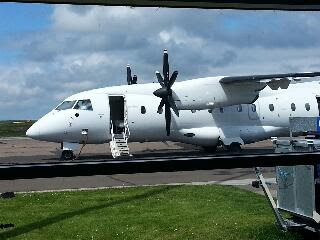
The flight from Edinburgh to Wick was delayed by an hour, which was apparently something to do with the crew having the wrong security passes. The flight was busy, with most people flying up for the Deloitte's cycle ride from John O'Groats to Land's End which starts on Saturday.My seat on the plane was double booked, but more worrying was being informed that I would have to open the cabin doors if there was an emergency! With the skies clear, there were fantastic views of the Forth Bridge and snow capped peaks.
The sun was shining in Wick and, as I had an hour or so to wait before I could check in to my B&B, I sat by the sea to read my many good luck messages. The B&B hosts were very welcoming and this will be a good base for the next couple of days.
Decided to eat at Wetherspoons in the town, where service was remarkably efficient compared to the ones down south. By coincidence, bumped into Harry there, one of the JOGLE cyclists who I'd sat with on the plane. We had a few beers and mulled over our respective journeys. So now the adventure begins for real.

Wednesday, 5 June 2013

My Kit

My rucksack is now packed. Here's the evidence! Total weight (including food and drink) is 14.5 kg (32 lbs)

Tuesday, 4 June 2013

My Itinerary

Day Date Day Start Finish Path
0 06/06/2013 Thur Home Wick
1 07/06/2013 Fri John O' Groats Wick
2 08/06/2013 Sat Wick Dunbeath
3 09/06/2013 Sun Dunbeath Loth
4 10/06/2013 Mon Loth Dornoch Brora to Golspie
5 11/06/2013 Tues Dornoch Alness
6 12/06/2013 Wed Alness Inverness
7 13/06/2013ThurInvernessInverness
8 14/06/2013 Fri Inverness Drumnadrochit Great Glen Way
9 15/06/2013 Sat Drumnadrochit Invermoriston Great Glen Way
10 16/06/2013 Sun Invermoriston South Laggan Great Glen Way
11 17/06/2013 Mon South Laggan Fort William Great Glen Way
12 18/06/2013 Tues Fort William Kinlochleven West Highland Way 
13 19/06/2013 Wed Kinlochleven Inveroran West Highland Way 
14 20/06/2013 Thur Inveroran Crianlarich West Highland Way 
15 21/06/2013 Fri Crianlarich Rowardennan West Highland Way 
16 22/06/2013 Sat Rowardennan Drymen West Highland Way 
17 23/06/2013 Sun Drymen Glasgow West Highland Way 
18 24/06/2013MonGlasgowGlasgow
19 25/06/2013 Tues Glasgow Larkhall
20 26/06/2013 Wed Larkhall Abington
21 27/06/2013 Thur Abington Beattock
22 28/06/2013 Fri Beattock Ecclefechan
23 29/06/2013 Sat Ecclefechan Carlisle
24 30/06/2013SunCarlisleCarlisle
25 01/07/2013 Mon Carlisle Penrith
26 02/07/2013 Tues Penrith Kendal
27 03/07/2013 Wed Kendal Carnforth Lancaster Canal
28 04/07/2013 Thur Carnforth Garstang Lancaster Canal
29 05/07/2013 Fri Garstang Preston Lancaster Canal
30 06/07/2013 Sat Preston Aughton Leeds & Liverpool canal
31 07/07/2013 Sun Aughton Liverpool Leeds & Liverpool canal
32 08/07/2013MonLiverpoolLiverpool
33 09/07/2013 Tues Liverpool Buckley Dee Marshes Path
34 10/07/2013 Wed Buckley Chirk Offa's Dyke Path
35 11/07/2013 Thur Chirk Llanymynech Offa's Dyke Path
36 12/07/2013 Fri Llanymynech Montgomery Offa's Dyke Path
37 13/07/2013 Sat Montgomery Knighton Offa's Dyke Path
38 14/07/2013 Sun Knighton Kington Offa's Dyke Path
39 15/07/2013 Mon Kington Hay-on-Wye Offa's Dyke Path
40 16/07/2013 Tues Hay-on-Wye Llanthony Offa's Dyke Path
41 17/07/2013 Wed Llanthony Monmouth Offa's Dyke Path
42 18/07/2013 Thur Monmouth Chepstow Offa's Dyke Path
43 19/07/2013 Fri Chepstow Gordano Severn Way
44 20/07/2013 Sat Gordano Stone Allerton Strawberry Line Trail
45 21/07/2013SunStone AllertonStone Allerton
46 22/07/2013 Mon Stone Allerton Taunton
47 23/07/2013 Tues Taunton Sampford Peverell GW Canal, W Deane Way
48 24/07/2013 Wed Sampford Peverell Black Dog Grand Western Canal
49 25/07/2013 Thur Black Dog Okehampton
50 26/07/2013 Fri Okehampton Lewdown Two Castles' Trail
51 27/07/2013 Sat Lewdown Launceston Two Castles' Trail
52 28/07/2013 Sun Launceston Mount
53 29/07/2013 Mon Mount Roche
54 30/07/2013 Tues Roche Truro
55 31/07/2013 Wed Truro Porthleven
56 01/08/2013 Thur Porthleven Mousehole South West Coast path
57 02/08/2013 Fri Mousehole Land's End South West Coast path